supertechsurvey01@gmail.com - GST NO. : 09ABGCS8017B1ZF
- Send Email


12.50 Lac / Piece
| Business Type | Exporter, Supplier, Trader |
| Number Of Flower | Robotic Total Station |
| Accuracy | 1° Angular Accuracy |
| Distance Measurement Precision | ±(1mm + 1ppm) |
| Click to view more | |
Product Details
Drive System
High-efficiency Motorized Drive System
Technologies
Automatic Precision Aiming, Automatic Prism Recognition (APR)
Surveying Software
Professional Surveying Software
Data Acquisition
Supports Continuous Point Collection And Rapid Measurement Modes
COGO Computations
Advanced COGO Computations Including Forward/inverse Computations, Intersection Solutions
CAD Integration
Full Compatibility With DWG/DXF Formats For Bidirectional Data Conversion
Road Engineering Module
Supports Alignment Design Through Intersection And Element Methods
Industry Applications
Land Surveying, Engineering Surveys, Infrastructure Construction
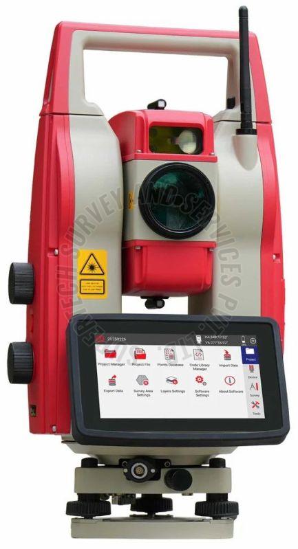
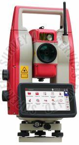
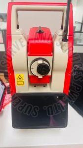
Robotic Total Station ALPHA R1
ALPHA R1 Robotic Total Station delivers exceptional measurement performance with 1″ angular accuracy and ±(1mm + 1ppm) distance measurement precision. Integrated with a high-efficiency motorized drive system and intelligent program control, it significantly enhances operational efficiency in complex surveying tasks. Its modular design supports secondary development for cross-industry applications, providing scalable solutions for customized engineering needs.
As a professional surveying solution that combines power, performance, and productivity, the ALPHA R1 utilizes industry-leading Automatic Precision Aiming and Automatic Prism Recognition (APR) technologies to enable fast prism locking and dynamic tracking, optimizing both time and cost efficiency.
Developed by integrating industry-leading surveying algorithms with decades of field-proven engineering experience, this professional surveying software establishes an efficient and reliable platform for field data collection and processing. Designed with user-friendly interfaces that align with modern surveying workflows.
•High-Efficiency Data Acquisition
Supports continuous point collection and rapid measurement modes to meet diverse accuracy requirements
•Advanced COGO Computations
Incorporates comprehensive coordinate geometry calculations including forward/inverse computations, intersection solutions, and precise area/volume measurements
•Seamless CAD Integration
Provides full compatibility with DWG/DXF formats for bidirectional data conversion between survey measurements and design drawings
•Comprehensive Road Engineering Module
Supports alignment design through both intersection and element methods, with multi-format data import functionality for highway and linear engineering projects
Engineered with operational efficiency, powerful functionality, and measurement reliability at its core, this solution has been widely adopted in land surveying, engineering surveys, and infrastructure construction, serving as an indispensable tool for enhancing surveying productivity and accuracy.
Looking for "Alpha Geo Alpha R1 Robotic Total Station" ?
Piece


